
Spray Park Trail & Falls
Waterfalls, Meadows, Cliffs, And More...

Introduction
The weather can't stop us
The day was filled with clouds and drizzle, with the temperatures in the high 40s. It was an early afternoon in early October when we set out. No snow falling, or already accumulated on the ground. There was plenty of wind howling through the trees. Views of Mt. Rainier were hidden behind the clouds. Spray Falls made up for that in a huge way.
With stops for photos, spending time at the falls, and having a quick lunch with our new friends, the hike took a little over four hours from start to finish. Two miles to the falls, another to the park, and a bunch of wandering in between left us with a total of eight miles traveled.
This is our story of Spray Park Trail on the north side of Mt. Rainier National Park…
Getting There
THE DRIVE UP IS ROUGH AND SLOW
To reach Mowich Lake you’ll take Highway 165 through the small town of Wilkeson. This is the last stop for gas — it’s 44 miles round trip before you’re back here again, so fill up now if needed.
Shortly after crossing Fairfax Bridge (don’t look down!) you’ll want to stay to the right where the highway will eventually turn into Mowich Lake Rd. It’s a gravel, washboard road filled with plenty of potholes — some much bigger than others. We averaged 15–25 mph along this portion which took 45 minutes to reach the lake. All vehicle types can make the drive as long as you take your time and pay attention.
Once at the top, you can park in the parking lot or along the side of the road. There’s a small campground with vaulted toilets available just past the lot. Walk past the restroom and you’ll find the trailhead on the right side of camp.
The Hike
SPRAY PARK TRAIL
You'll begin the hike with a slight drop in elevation. In a short distance you'll reach a trail intersection point.
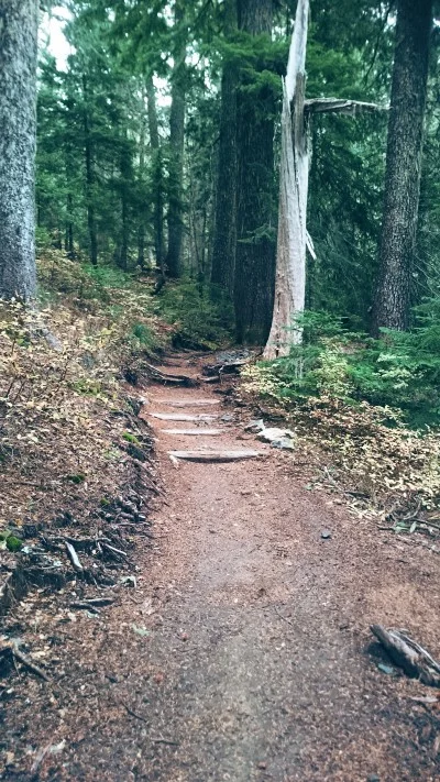
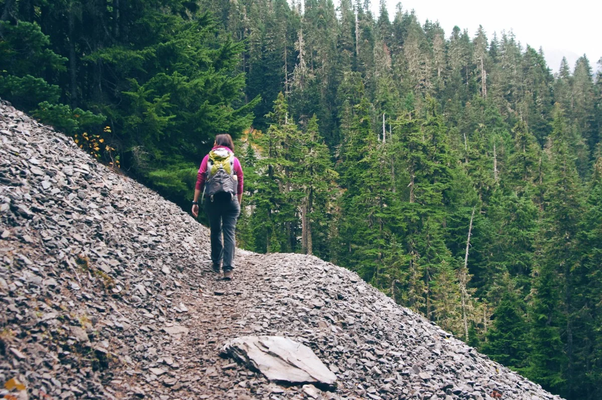
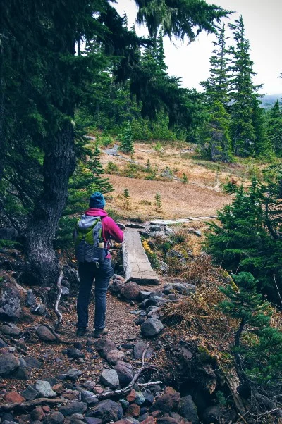
Stay to the left for Spray Park Trail and continue your journey through the heavily wooded area. While we visited the wind was howling hard which in turn created creaking sounds from trees throughout the day.
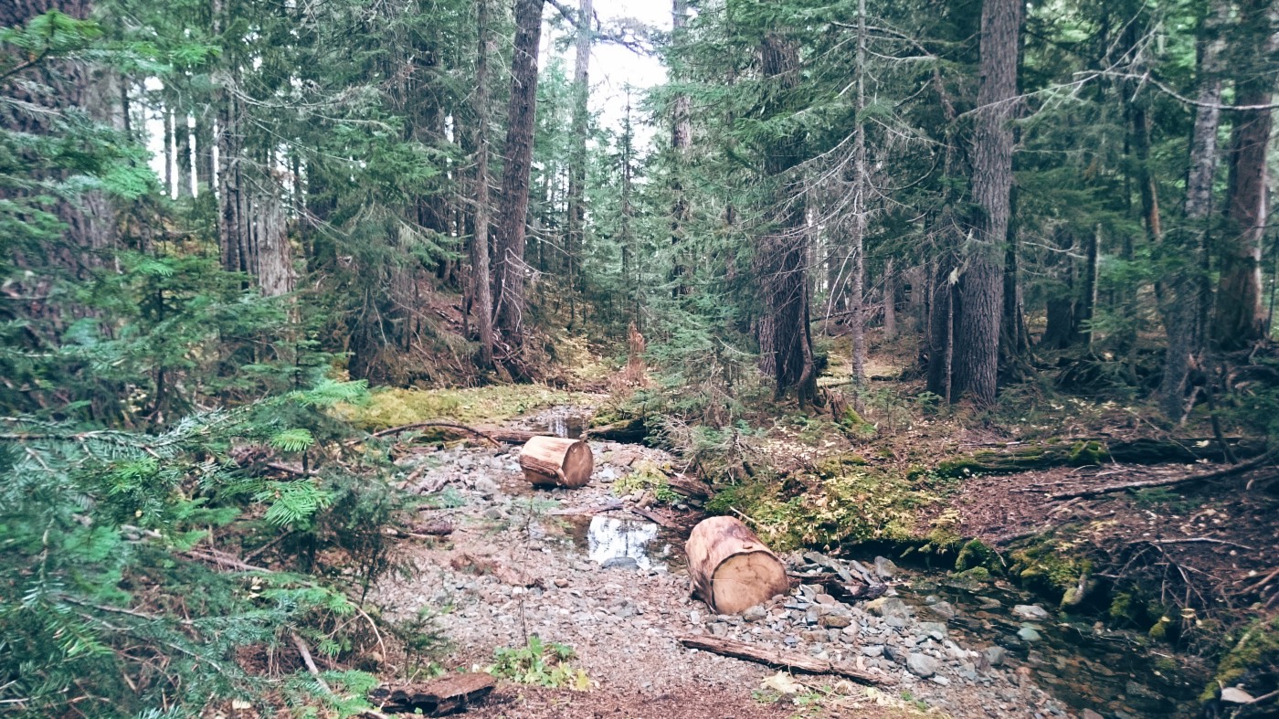
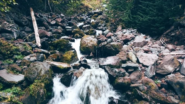
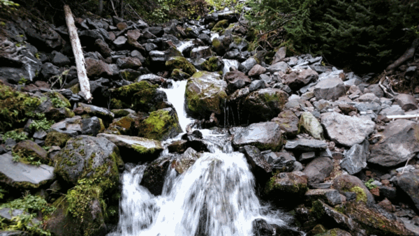
There are single log bridges that cross over the various streams and creeks. Some with railings, some without. All very safe to cross. There’s also plenty of mushrooms growing about. The trail will start to climb again and from here it’ll be an up and downhill battle the rest of the way.
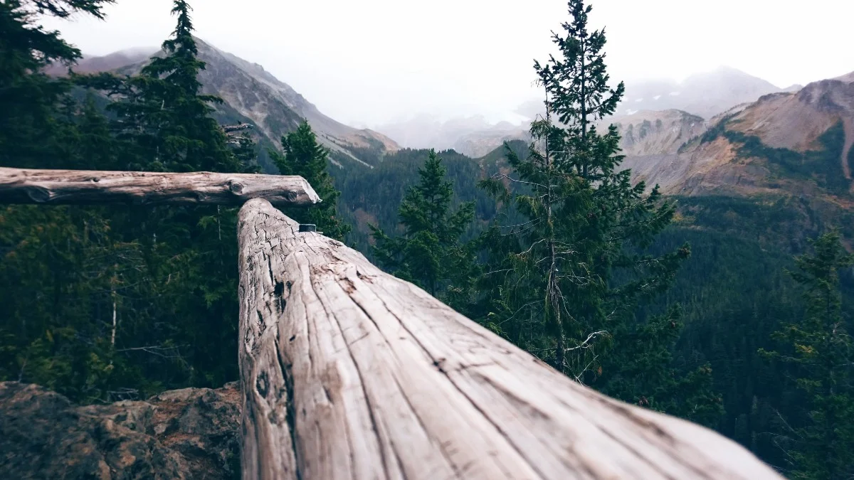
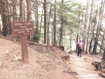
1.5 miles along your journey you’ll come by a trail sign notifying you that Eagle Cliff viewpoint is off to the right. It’s only 100' off the main trail which gives you no reason to pass it up. Due to the cloudy day we weren’t able to see Mt. Rainier. However, this should be a great spot to view the mountain, as well as Mowich Glacier, while it’s clear out. The cliff is definitely a cliff so be careful!
Once you’re back on the main trail continue a bit further until you come to the next way point — a trail sign pointing to Eagle’s Roost Camp, a wilderness campground off to the right. We opted to skip it, but it’s only a tenth of a mile off track if you’re interested in exploring further.
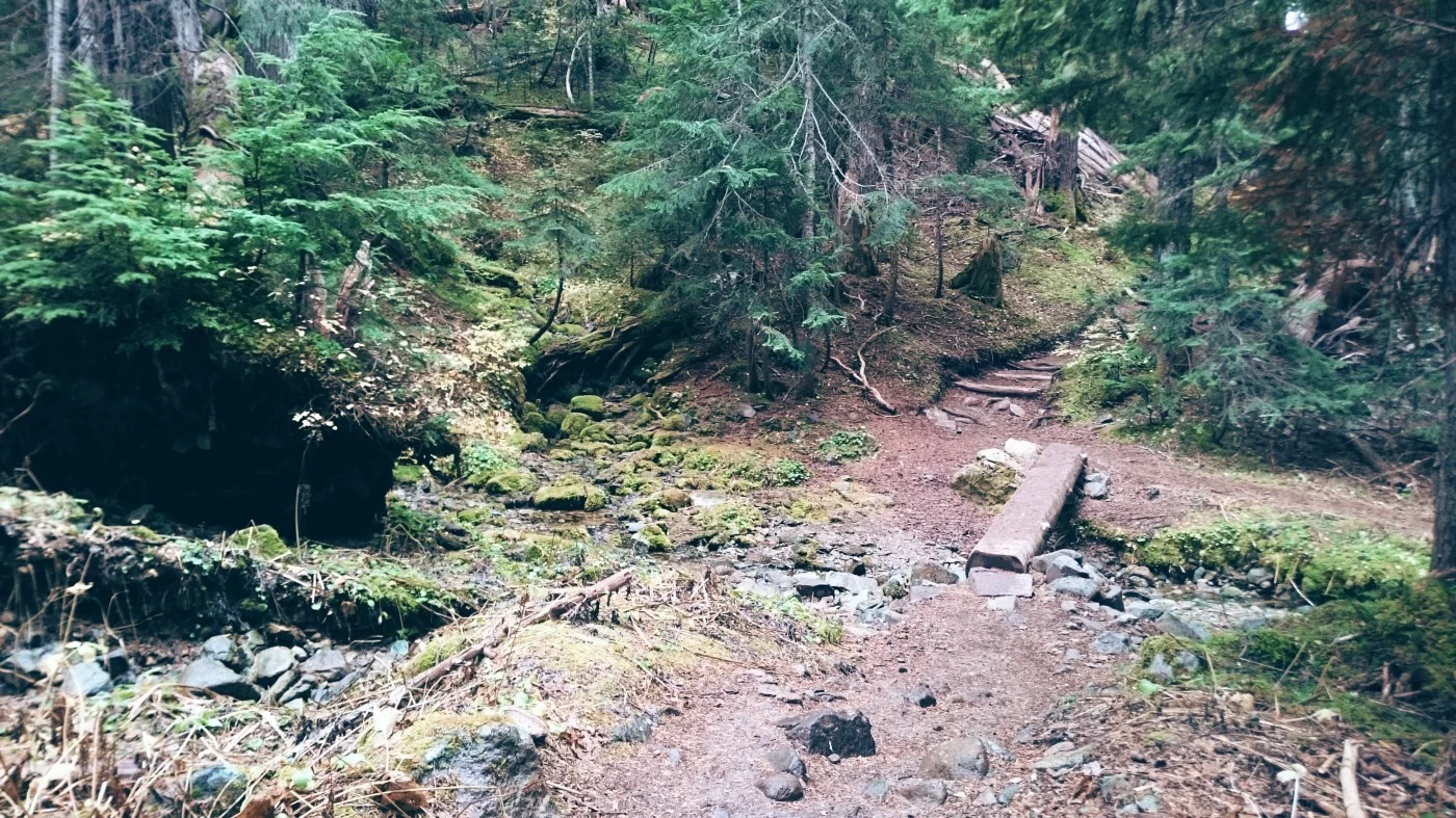
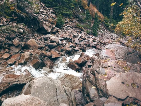
Continue on for another 0.1 miles until you reach water. You’re almost to Spray Falls but first you must cross Spray Creek. The waterfall here is the best one so far into the hike. So much so that we initially thought this was Spray Falls since we didn’t see any photos or read about it beforehand. You’ll cross over another single log bridge with rushing water below you.
Stop here for photos, videos, and to prep your camera for what comes next. You're almost there!
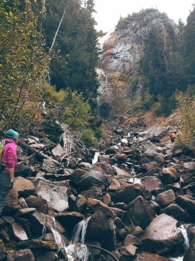
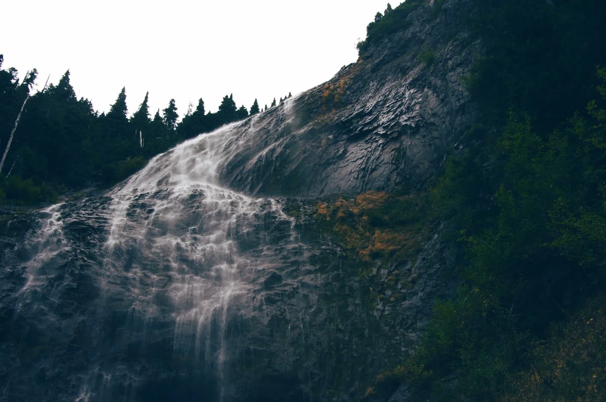
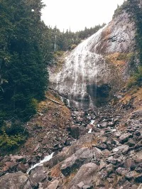
Spray Falls
MUCH LARGER IN REAL LIFE
After leaving the bridge, the trail will lead through a treeless and rocky area which bends to your left around the mountain. You’ll begin to hear the river and soon enough you’ll see large rock in and around it. There are trees on your left that obscure the view of the falls. Once you make it around those trees — Wow!
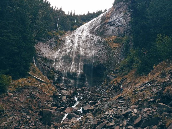
Plan on spending 30 minutes or more exploring this area and taking photos. You’ll have to cross the water if you want to be as close as possible to the falls. Be careful as you walk and balance along the large rocks, they’re slippery. Once you make it across, continue climbing the rocks upwards towards the mist. Again, be very careful here as well since it’s hard to tell if these rocks are wet or not.
You won’t need to go too far up in order to find a great spot for photos. Be sure to bring wet weather gear if you‘re aiming to get as close as possible. You’ll need it!

After you’ve taken in all the beauty you can handle you now have a decision to make: head back or continue on to Spray Park? We decided to trek a little further in the hopes of seeing some wildlife — which we did :-)
On to Spray Park
UPHILL FOR A MILE
Once you’re done visiting the falls, hike back to the main trail and continue it upwards. The trail sign says 0.8 miles to the park but it felt like a lot more. You’ll be climbing a steep hill with switchbacks, streams, and small waterfalls along the way.
Eventually you’ll reach another single log bridge that will lead to an opening. You’ve found meadows. There’s no sign indicating that you’ve reached the park but this entire area and further is all considered Spray Park. Rightfully named as the water you come across all leads to the falls you just visited.
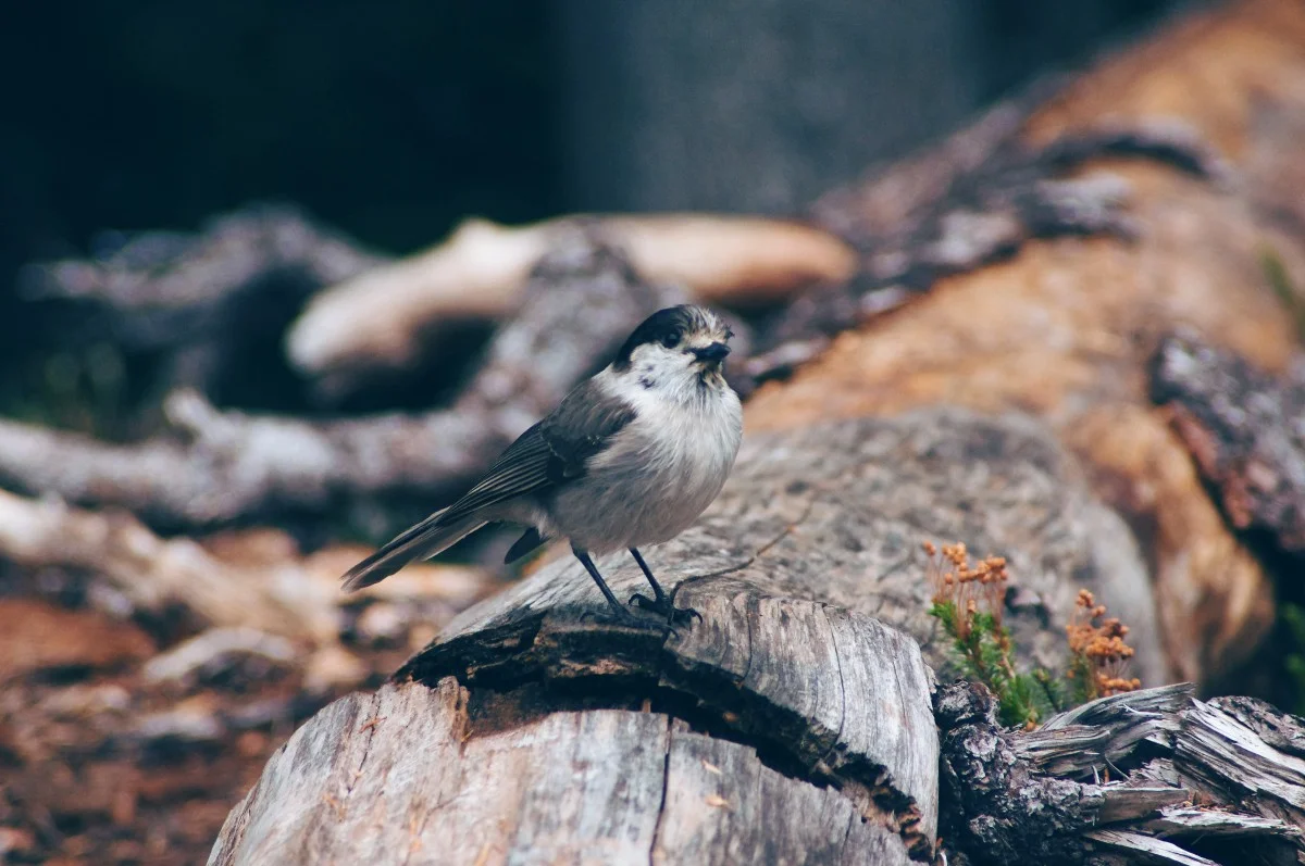
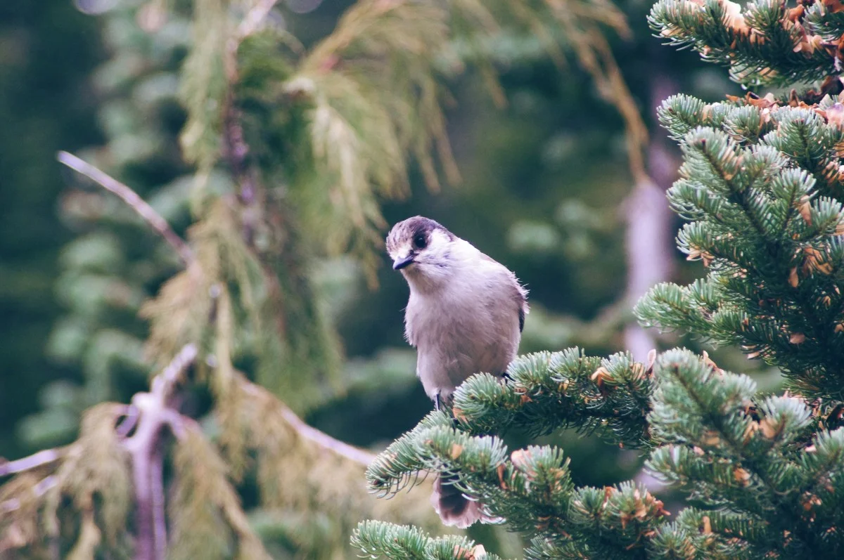
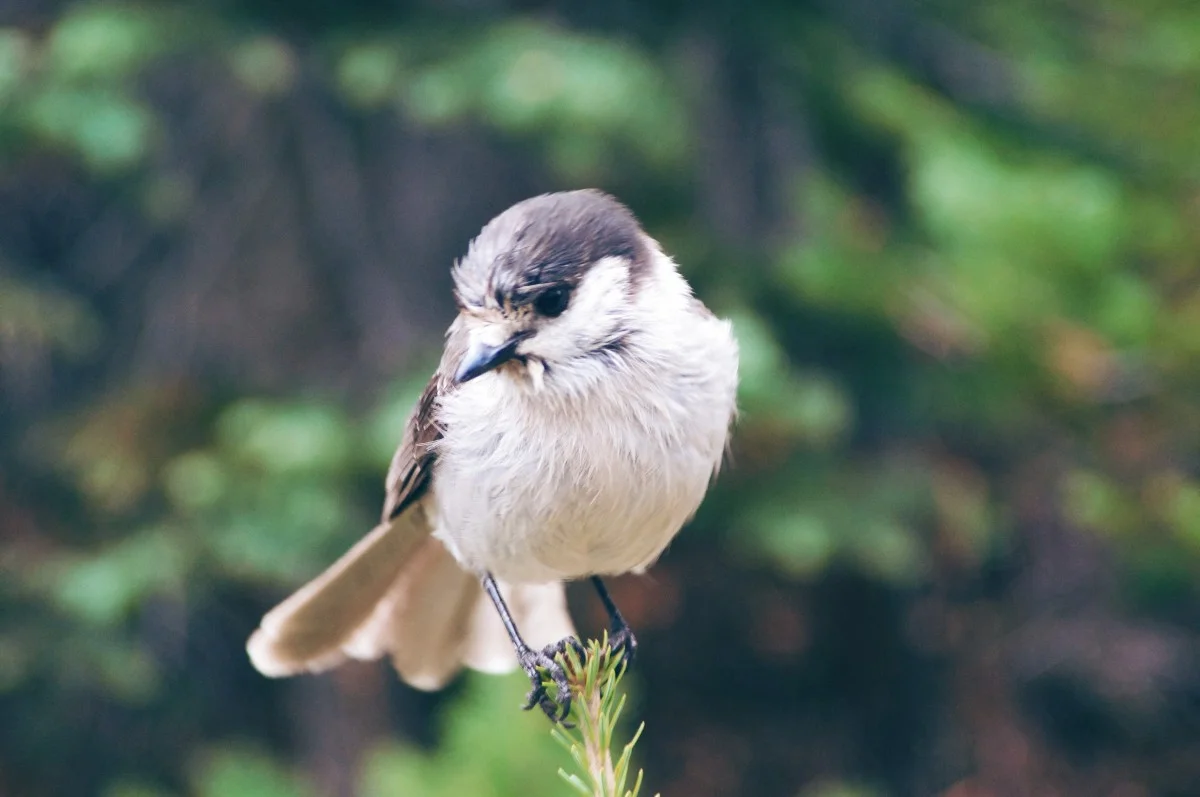
We continued on for another quarter mile and found a nice log to sit upon for lunch. We also had some visitors with us that were hungry as well. About four or five of these little guys joined us, begging for a bite. They came so near as to land on a knee of ours with the look of friendliness and the thought of, “Why won’t you share some of that peanut butter with us? We like peanut butter.”
Other than the birds, we saw a few deer tracks, and that was it for wildlife. We were happy with that. Now it’s time to pack up and start heading back.
It was a steady hike without any stops. We reached the starting point 15 minutes shy of two hours. The lot was as full as when we started — only two or three other vehicles parked.
During the whole trip we ran across two other groups of people. One was at the falls as we arrived and the other was reaching it just as we were leaving.
Our Final Thoughts
LET'S DO IT AGAIN SOMETIME
Although it was cloudy and we were unable to see the mountain, we still had a fantastic, up close and personal view of the falls. And that was the best part of this hike!
The hardest part was the additional portion to Spray Park. This is a pretty easy going trail if you chose to skip that portion. There’s up and downs along the way so you’ll have plenty of time to break, catch your breath, and take photos.
We’ll be visiting again so we can get that view of Mt. Rainier from Eagle Cliff!
Hey, we appreciate your readership! If you're in the market for new gear and would be willing to make your purchase through our Amazon link, we might get a small commission out of it. No additional cost to you and maybe a little something for us!
Thank you for your support!
Interesting Stops Along the Way
Explore more...
Fairfax Bridge
(As soon as you cross the bridge there’s a pullout area on the left side of the road that will accommodate 3–4 vehicles. Stop for photos!)
Helpful Links for Exploring Spray Park Trail & Falls
Use these while planning your journey
NPS pass info for Mt. Rainier
(You'll need a pass to enter the park.)Mt. Rainier road status page
(Make sure Mowich Lake Rd. is open before you go!)
Follow along on our wanderings around the Pacific Northwest.
The only thing better would be being there yourself!
Subscribe to Our Newsletter