
Hiking the Green Lake Trail
Carbon River, Ranger Falls, Freezing Temps, And More…

It was 9:31 A.M. when we parked, according to the Jeep it was 37 degrees out, and there was a drizzle of rain. The forecast called for heavier showers around 2–3 P.M., so we hoped to be back before then. A quick potty break, then off we went. We reached the lake at 12:40 P.M., it was now around 32 degrees with snow just above the lake. Our time here would be brief.
“The clearest way into the Universe is through a forest wilderness.”
Getting There
We accessed Mt. Rainier National Park through the Carbon River entrance, about 2 miles beyond the Ranger Station. The road ended at a parking lot where the Ranger Station used to be. The trailhead was still 3 miles ahead. Only bicycles and foot traffic from here. We rounded the gate that blocked the gravel road and proceeded on foot.
If you're interested in riding your bikes to the trailhead and further, have a look at this post of ours.


The road was in decent condition and it made for an easy start. There were trails off the right and left of us. One trail was the Washington Mining and Milling Company Mine, which had a small parking lot at the trailhead. Continuing on, the road became slightly rougher and we crossed two wooden bridges. The second bridge looked very new and we judged it to be roughly halfway to the trailhead from here.
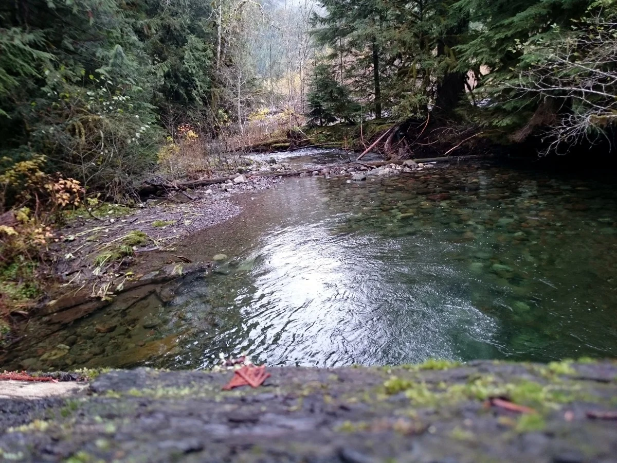
This road paralleled the Carbon River most of the way with views of misty and snow dusted mountain peaks. We passed numerous, majestic old growth Douglas Fir trees, some purportedly 800 years old. We noticed bicycle tire tracks, footprints and hoof impressions left by deer, but we encountered no person or animal.


The Hike
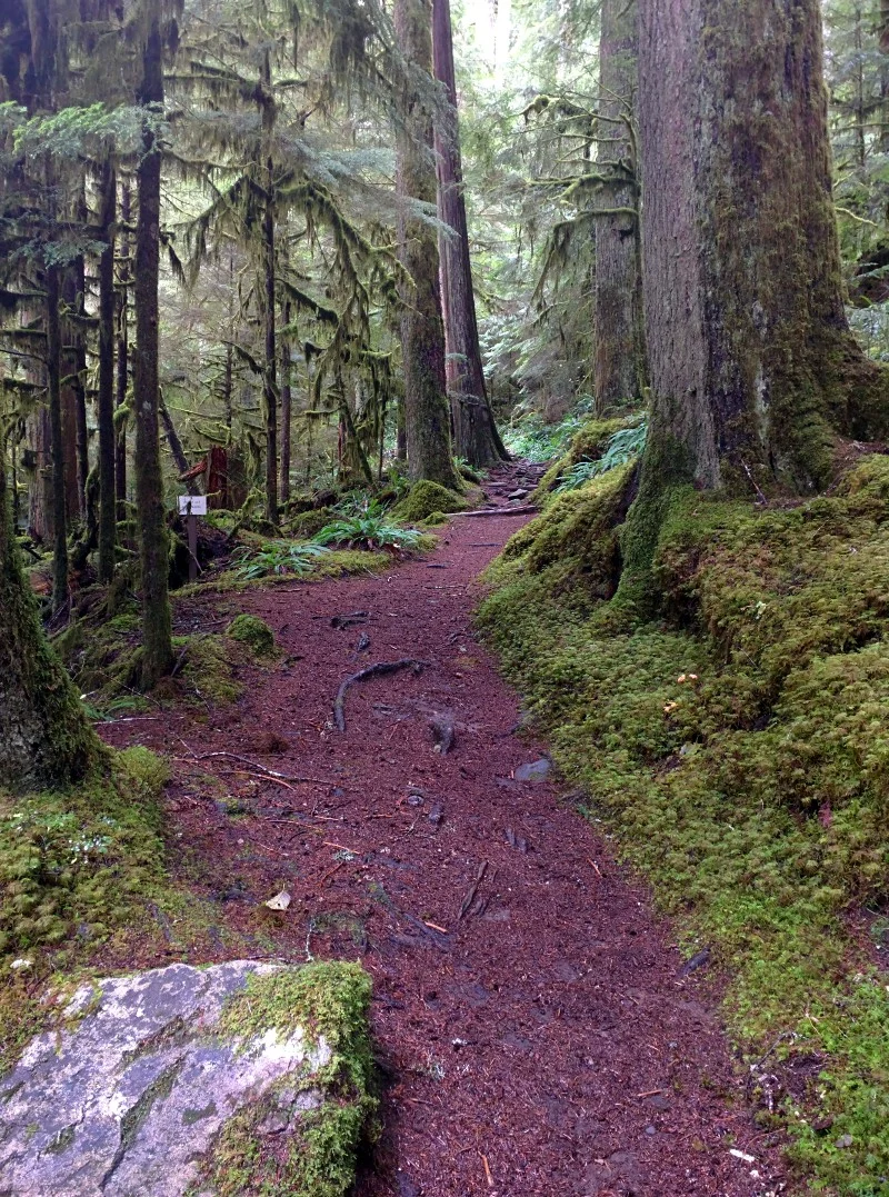
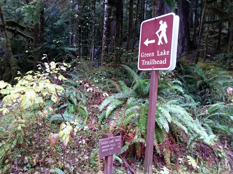
The trailhead was clearly marked with signs for Ranger Falls 1 mile ahead and Green Lake 1.8 miles. The trail starts upward and continues upward the entire 1.8 miles via a series of switchbacks with many fortified steps. This was like stepping back in time, way back. There were a number of downed trees, enormous in size. None of these posed as obstacles to the path, but formed arches or bridges. The trail was well maintained, with few muddy areas.
The surrounding landscape was a carpet of lichen and fern and one could easily imagining turning a corner to find a munching Stegosaurus. Aside from the occasional chirping of birds, trickling of water and wind in the tree tops, this was a serenely quiet place.


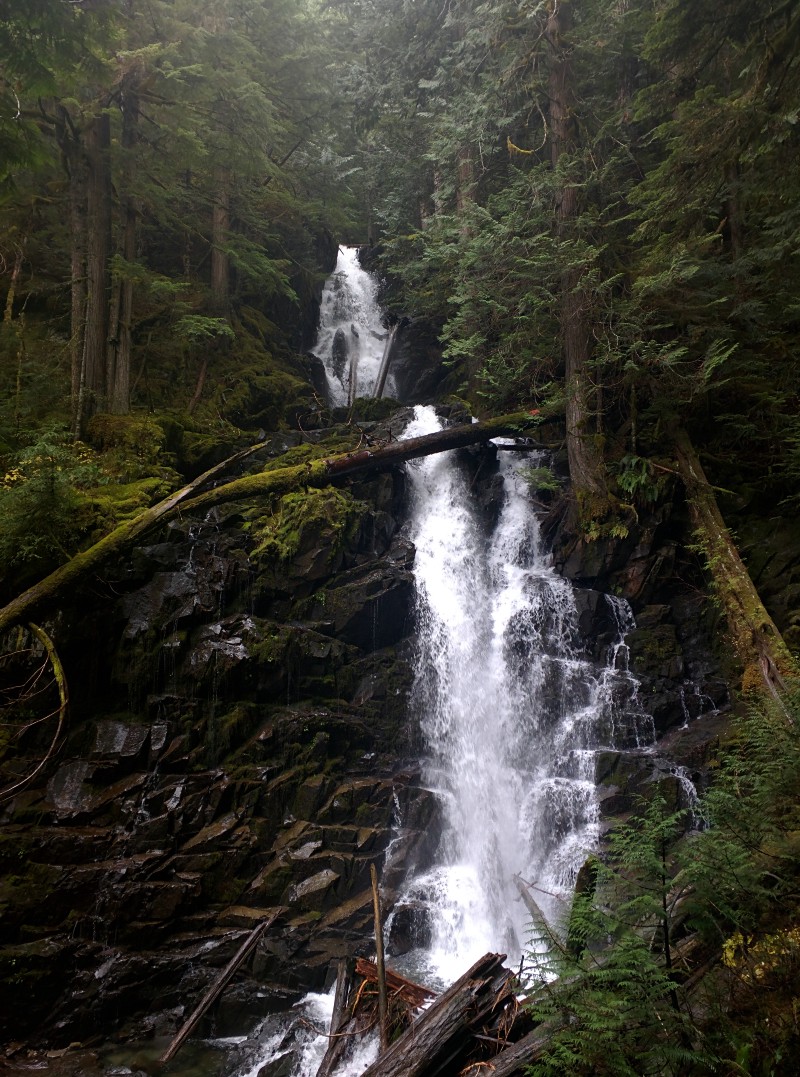
The rain began to increase as we approached the sign to Ranger Falls. A short 200 foot diversion was well worth the effort. This was actually a splendid set of falls to view. The viewing platform was a great spot for photos as it is directly across from this multi-tiered waterfall. We took photos here, then got back on the main trail to the lake.


Continuing ever upward, the trail narrowed a bit, the frequency of the switchbacks increased and became steeper. This continues for 0.8 miles. The trees thinned ahead and the trail leveled, leading us to the single log footbridge that crossed Ranger Creek. This bridge had railing only on the left, there were notches cut into the foot surface for traction, but was still a little slick with rain. The temperature cooled noticeably and the wind picked up from this point.


The trail from the bridge sloped downward slightly and very soon we arrived at Green Lake. This was the end of the maintained trail. There were still numerous trails in several directions from there. Immediately ahead the trees opened to the lake. A beautiful, green hued water circled by snow dusted trees. The lake was perfectly calm aside from the ripples caused by the raindrops. There was a log jam at this spot that lent interest to our photos. It was misty with snow on the ridges, but Tolmie Peak is supposed to be visible from this spot on clear days.
It was quite cold and the rain was falling more steadily now with snow swirling just overhead. We decided not to linger too long. We took a few photos, found a log to perch on while we each ate half a peanut butter banana sandwich and hydrated. A couple of Grey Jays lighted nearby to inquire if we’d share our lunch. These were the same kind of bird that lunched with us in Spray Park. With clothing adjustments to account for the drop in temperature, we put our packs back on and began the trek back.


“Getting to the top is optional. Getting down is mandatory.”
Returning
The way back was easier, being primarily downhill. Being cautious for slippery spots, we still were back to the trailhead within 50 minutes. In this instance, gravity was our friend. The trip back to the parking lot via the road was unremarkable. We do plan to return and visit Ipsut Creek Campground and will likely bring bikes to tackle this distance next time. Total trip time was 4.5 hours and 10.8 miles.


Our Thoughts
This is the Pacific Northwest, so rain and chilly temperatures are regular occurrences. Checking forecasts and dressing appropriately are your best head starts for any hike, Green Lake is no different. This is a trail through a majestic forest with waterfalls, mountain peaks and a beautiful lake. While considered family friendly, it is a 10 mile round trip from the parking lot. Plan well, pack well and hit the trail!
Hey, we appreciate your readership! If you're in the market for new gear and would be willing to make your purchase through our Amazon link, we might get a small commission out of it. No additional cost to you and maybe a little something for us!
Thank you for your support!
Explore More
Other interesting stops along the way
Fairfax Bridge
(As soon as you cross the bridge there’s a pullout area on the left side of the road that will accommodate 3–4 vehicles. Stop for photos!)
Helpful Links for Exploring Green Lake and the Carbon River Area
NPS — Pass info for Mt. Rainier
(You’ll need a pass to enter the park.)
Follow along on our wanderings around the Pacific Northwest.
The only thing better would be being there yourself!
Subscribe to Our Newsletter