
Hiking Umatilla Rock Trail
A Journey Into Washington's Geological History
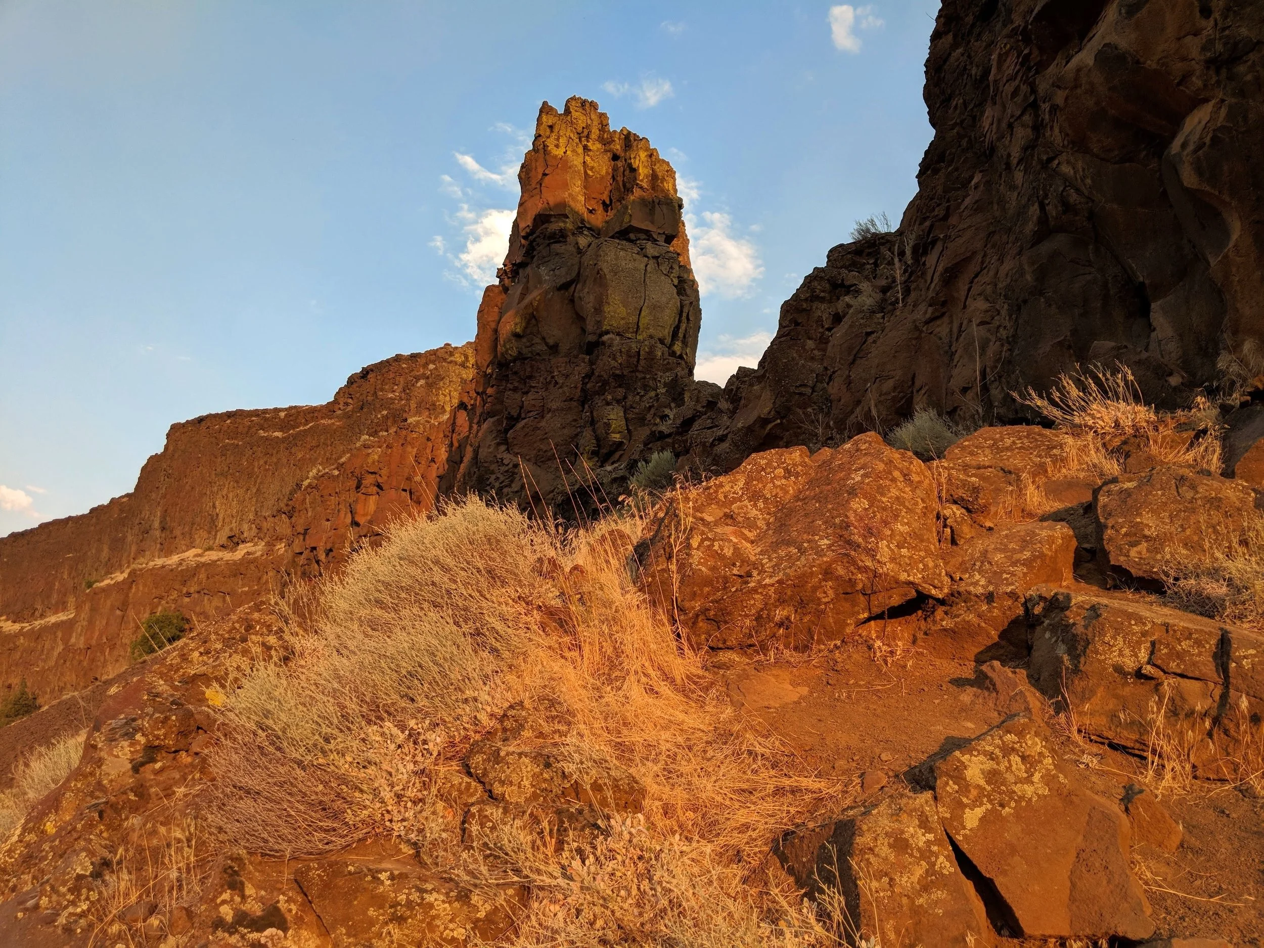
Umatilla Rock at sunrise
An early morning hike is never a bad idea. You get to watch the sunrise while enjoying the cooler part of a summer day. On a recent trip to eastern Washington, beating the heat was a must for us. We explored and hiked around, up and over Umatilla Rock and Dry Falls. This easy hike provides breathtaking views of what was once the world's largest waterfall.
“We don’t stop hiking because we grow old –
We grow old because we stop hiking.”
History of Umatilla Rock, Dry Falls, and Grand Coulee
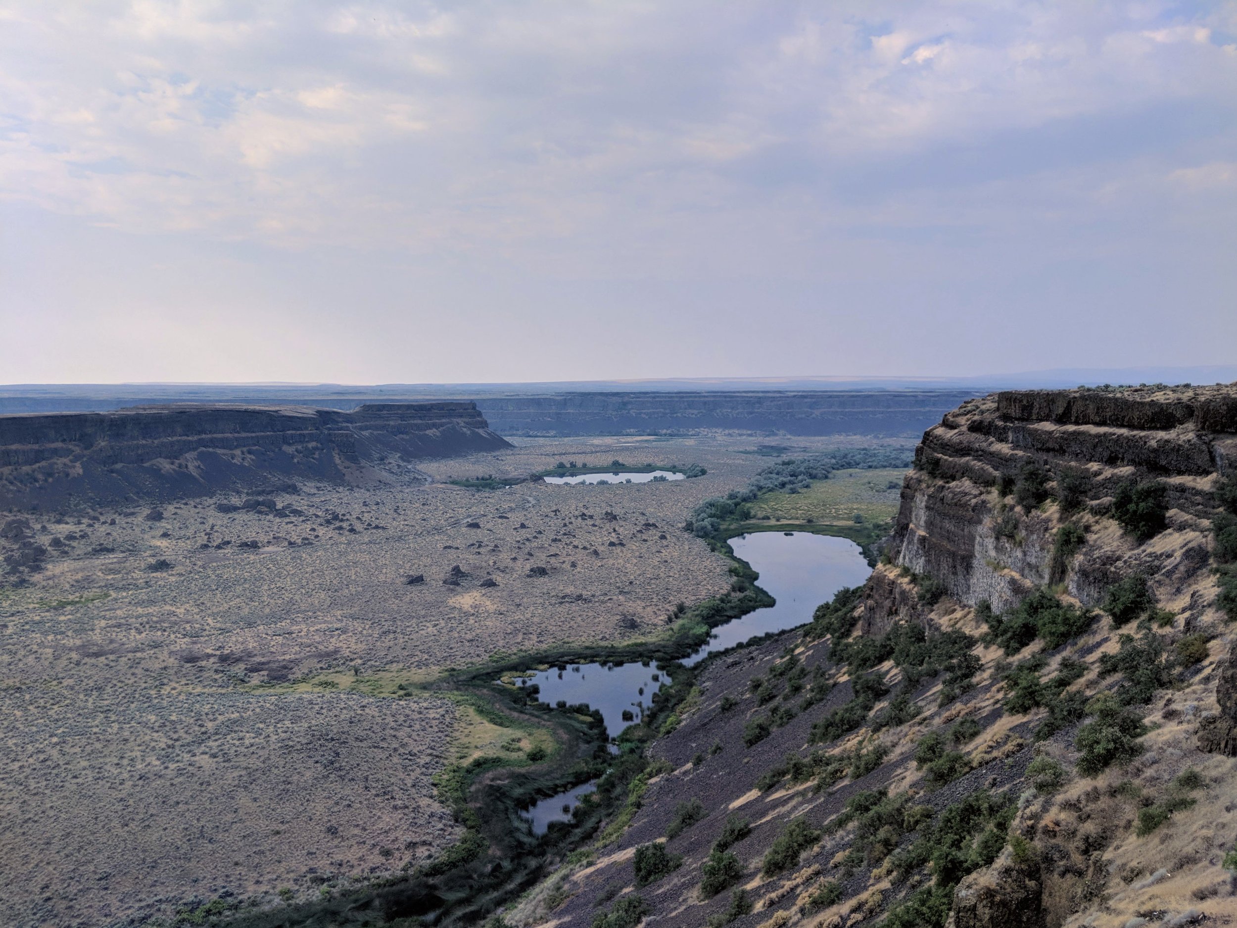
View of Dry Falls from Visitor Center
Umatilla Rock is situated downstream of what is now known as Dry Falls. The falls were 400-feet tall and estimated to be roughly five times the width of Niagara Falls, with a flow rate ten times that of all rivers in the world combined. These falls, which stopped flowing about 10,000 years ago, remain one of North America's natural wonders.
Together, Dry Falls and Umatilla Rock are located in the central area of Grand Coulee, an ancient river bed once home to Ice Age Floods. The coulee runs some 60-miles from Coulee Dam south to Soap Lake. Grand Coulee was added to the National Natural Landmarks register in 1965, making it one of only 18 such sites in the state of Washington.
Today, the area is home to many species of wildlife, numerous lakes, and countless recreational opportunities. Steamboat Rock State Park and Sun Lakes-Dry Falls State Park are located in the area, each providing activities such as camping, hiking, watersports, and more. Sun Lakes-Dry Falls State Park is home to Umatilla Rock, and was our campsite for two nights.
If you're still curious about the geological story of this area, like we were, have a look at The Channeled Scablands from the website The Seven Wonders of Washington State.
Hiking Umatilla Rock Trail
An early sunrise hike on Umatilla Rock Trail
Heading to eastern Washington in the middle of the summer. Were we crazy? No.
We've done this in the past without ever being let down. Previous visits to Bridgeport State Park, Lake Lenore Caves, and Ginkgo Petrified Forest State Park have treated us well. What grabbed our attention this time around was a recent Twitter photo from Essex eXplorers at Blythe Lake, near Potholes State Park - by the way, if you're into citizen-science, make sure to check out Essex Media & Explorations. The image reminded us that eastern Washington is a great part of the state to visit and that we should get back out that way. We’ve been to Potholes State Park twice, and it’s a fantastic park, but heading east this time we would pick a new location we’ve yet to explore.
We arrived at Sun Lakes-Dry Falls State Park around sunset, Friday evening. The temperature was in the upper 90s, maybe even reaching 100+ that day. It was sweltering out. We quickly set up our campsite, explored the park a bit, then attempted to sleep for the night.


It was unbearably warm. The heat made for a fitful night in our tent, dozing briefly only to awaken because it was just too hot. Even though we didn’t have to use the restroom each time we awoke, we still walked to it, knowing that the short stroll would provide a small bit of comfort.
We woke again at 4:30am, and the temperature had finally dropped a few degrees. At that point, we decided to just get up and prepare for our hike. Waiting any longer was just going to make the day worse. We were ready to go by 5:00am. We had the option of driving to the trailhead but opted to walk there. This added about a mile to the hike each way. Before we set out, we were greeted by a few deer.


As we set out, the night was already fading, and the sky was beginning to turn blue with clouds scattered about. By the time we reached the trailhead, the sun was peeking over the cliffs in the distance. We made a smart choice by starting our hike early. The sky was streaked with pinks, oranges, and yellows of a lovely dawn. Sunrise was here, and it looked fantastic.


The route we chose had us facing the sun on this early part of the day while the temperatures were still tolerable. Rocky and dry, the grasses were mostly straw colored along our path. Swatches of green vegetation stood out, marking low lying areas that were able to hold any rains that the region might receive. Clusters of rocks and large boulders were scattered about and provided shade and shelter for the creatures adapted to this climate. There had been recent rains as was evidenced by the numerous flower blossoms that poignantly accented this otherwise parched landscape.


The trail branched several times and circled the entire length of Umatilla Rock, we decided to take the route that led up through a notch so we could take in the views from on high. This notch likely has a name, but we decided to call it Wanderer’s Notch. The trek up to this cut-through was tricky, loose sand and rock made it difficult to get traction, but we made it. Looking down toward the direction from which we had come was the valley laid out in amber, and pale green with trails clearly cut through the grass and brush. Looking down on the side that now lay before us revealed the same golden hued grasses, but faceted with vibrant green grass and blue-hued bodies of water, something resembling a golden crown be-fitted with emeralds and sapphires.


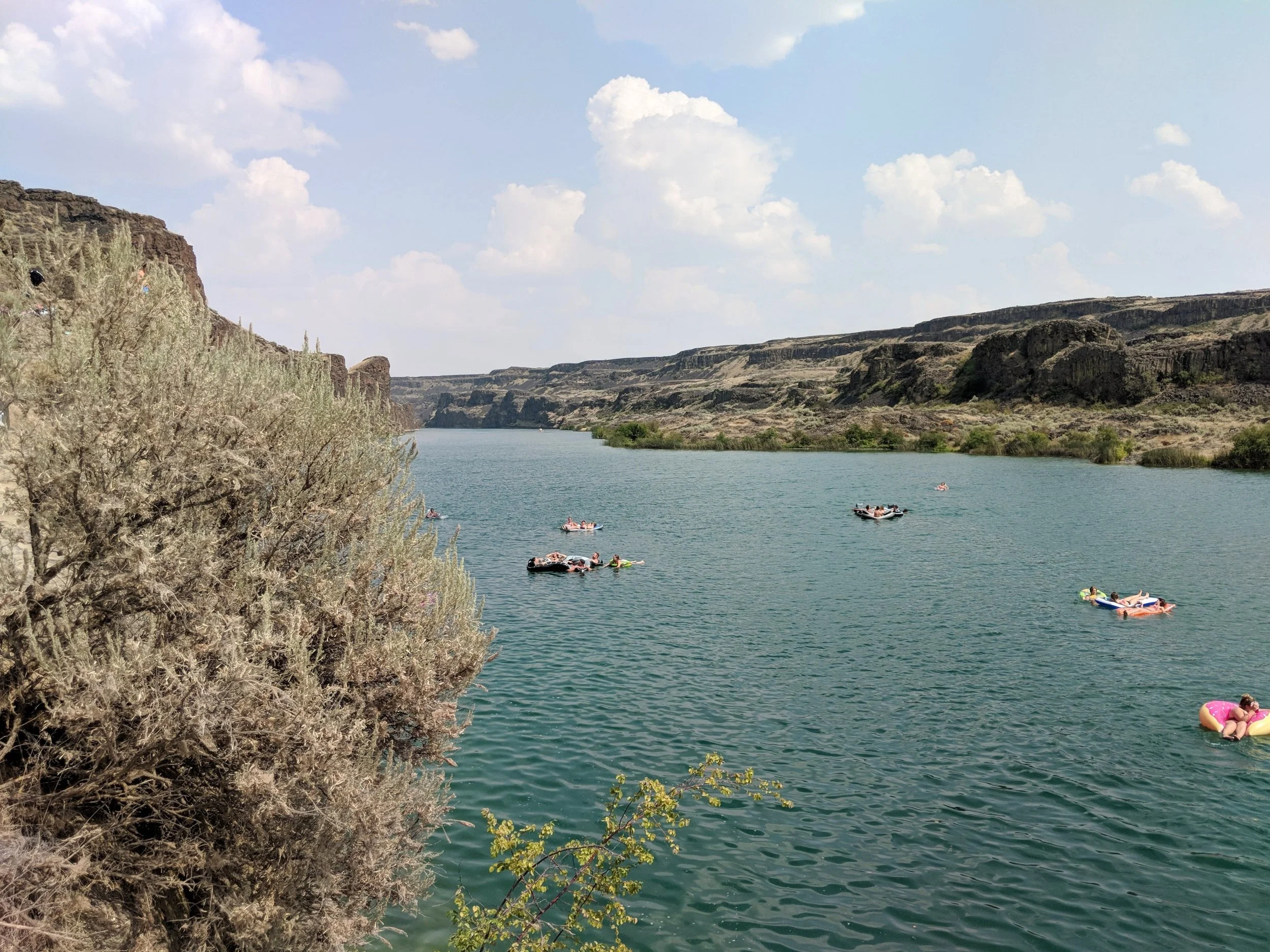
We scrambled and slid down with the tumble of rocks and sand that was our path, to find it cooler here near the water. The grasses and bushes were much taller at Dry Falls Lake and served as home to a cacophony of birdlife. There seemed to be an unusually high number of dragonflies flitting about all around us, giving this spot a storybook quality. As we made our way to drier portions of the coulee, the air was heavily scented with sage. Looking up on the ridge that bordered this valley, the Dry Falls Visitors Center stood overlooking where we now stood.


We took the path that led us around to Perch Lake, this was another watery oasis surrounded by verdant green vegetation. We crossed a dirt road then headed back toward the trailhead. The day was sufficiently hot by now, so we quickened our pace back to camp. Because of our early start, we had only seen people in vehicles, but no other hikers.


During our hike, we saw deer, quail, and turkeys. Once back at camp, we drove to the Visitors Center and took in the views from this terrific vantage point. The geological history of the area is explained in great detail here, and it is an excellent spot for photos. Though we’d had a restless night, we were newly invigorated and inspired.


Final Thoughts

PS They have minature golf at the state park!
Summers in eastern Washington are hot. The landscapes are vastly different than what is familiar to us on the west side of the state. These differences are what make our journeys east so enticing. We’re always impressed with the abundance of wildlife that seems so counterintuitive to a place so dry and seemingly harsh, but in the words of Jeff Goldblum in Jurassic Park, “...life, uh….finds a way.”


Have you been to Umatilla Rock or the nearby state parks before? Are you interested in going? What's your favorite part of eastern Washington that you love to explore? Let us know in the comments below. Happy Trails!
Hey, we appreciate your readership! If you're in the market for new gear and would be willing to make your purchase through our Amazon link, we might get a small commission out of it. No additional cost to you and maybe a little something for us!
Thank you for your support!
Helpful Information & Links
Coordinates: 47.590909, -119.367509
Trail Length: ~3 miles roundtrip from trailhead. ~5.2 miles from campsite.
Elevation Gain: 352'
Time Hiking: 3 hours 17 minutes
Difficulty: Easy
Pass Required: Discover Pass
Follow along on our wanderings around the Pacific Northwest.
The only thing better would be being there yourself!
Subscribe to Our Newsletter